![]()
![]()

We need your help! 🔥
Please consider disabling your ad-blocker to support this website! 🔑
We are a free, community-supported website! 🥰
We only display small unobtrusive ads which help us stay online! 💯
Thank you in advance! ❤️
We are a free, community-supported website! 🥰
We only display small unobtrusive ads which help us stay online! 💯
Thank you in advance! ❤️
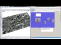
Import Topo
Create a topographic mesh from a raster file (IMG, HGT, ASCII, DEM, TIF, etc) clipped to a boundary
Inputs
| Name | ID | Description | Type |
|---|---|---|---|
| Boundary | boundary | Boundary curve(s) for vector data | Curve |
| Topography Raster File | topoFile | Filepath for the raster topography input | Text |
Outputs
| Name | ID | Description | Type |
|---|---|---|---|
| Topography Mesh | topoMesh | Resultant topographic mesh from the source file | Mesh |
| Topography Extent | topoExtent | Bounding box for the entire source file | Rectangle |
| Topography Source Info | topoInfo | Raster info about topography source | Text |


Site design © Robin Rodricks.
Heron and associated data © 2025 Brian Washburn.
Rhinoceros and Grasshopper are registered trademarks of Robert McNeel & Associates.
Hosted by GitHub